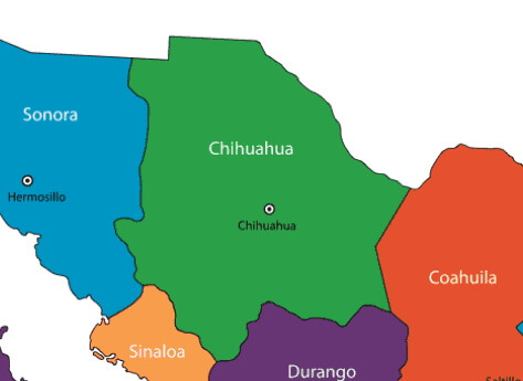
The northwestern state of Chihuahua is located on the border with the U.S. states of New Mexico and Texas. It borders the Mexican states of Durango, Sonora, Sinaloa, and Coahuila. Nicknamed El Estado Grande, Chihuahua is the country’s largest state with an area of 95,543 square miles. As a border state, Chihuahua sees many travelers. While known for its handicrafts, it is also famed for its rugged landscape.

Important State Facts
Chihuahua is home to 2,440,688 people and is the nation’s eleventh most populous state. Its most populous city is Ciudad Juarez, but the city of Chihuahua is the state’s capital. Chihuahua became a state in 1824. Today, most people live near the Rio Grande Valley or the Conchos River Valley. Much of the state’s terrain is rough, dry, and mountainous.
Geography and Environment
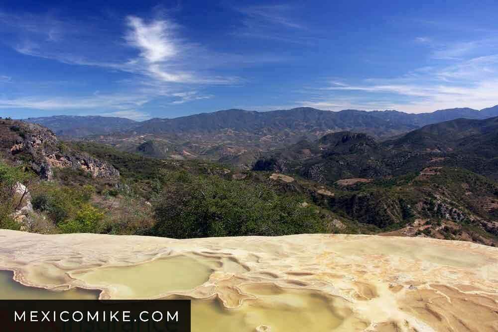
Chihuahua has a varied climate due to its three distinct geographical regions: mountains, plains, and desert. The Sierra Madre Occidental range accounts for about a third of the landscape; the highest point of the mountainous terrain is Cerro Mohinora, an extinct volcano. Yet, within the mountain range are valleys of coniferous forests making Chihuahua a bountiful source of the nation’s wood.
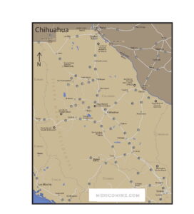
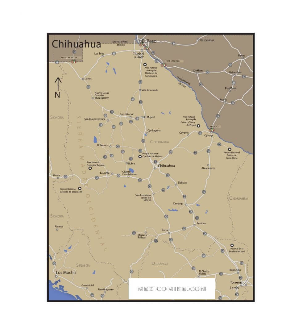
Click here to find the Chihuahua Maps (City and State). You can download the maps to your device for your convenience.
The mountains also have stores of minerals that have made mining an important Chihuahua industry. The plains begin at the foot of the mountains. They lie between the Sierra Madre Occidental and the desert. The desert lands also account for roughly a third of the state’s area; the Chihuahuan Desert forms part of the landscape of Coahuila and Durango as well as New Mexico, Texas, and Arizona. The Chihuahuan Desert is the second largest desert in North America. In spite of the desert climate, it contains Chihuahua’s largest city, Ciudad Juarez.
History
The area of Chihuahua saw humans between 12000 B.C. and 7000 B.C. These early hunter-gatherer groups later developed farming and grew corn. According to historians, by the time the Spanish arrived, there were as many as 200 indigenous groups in the area. There is archaeological evidence suggesting that these tribes had both cultural and commercial connections with other groups outside the region. During the Spanish Colonial period, the area was a mining haven. There were several large uprisings throughout the area as the Native Americans fought Spanish authority.
After the Mexican War of Independence, turmoil ensued in Chihuahua culminating in an ethnic war. This war resulted in heavy losses of life for groups like the Apache and Comanche. The subsequent Mexican-American War then resulted in considerable losses for Chihuahuan troops. After 1910, Chihuahua saw Pancho Villa fight for land grants and political representation for Mexican peasants. Consequently, Chihuahua was the main battleground during the Mexican Revolution. Today, Chihuahua is home to the world’s fifth-largest oil company. The state is beginning to see the benefits of the North American Free Trade Agreement of 1994.
Flora and Fauna
Due to its various microclimates, Chihuahua has a wide array of plant life. Pine trees are among its most plentiful tree species, but oak and fir trees also grow in the state’s mountainous forest regions. Agave and various types of cacti grow throughout the desert region of Chihuahua as do many other plants that thrive in dry conditions. Chihuahua boasts diverse animal life due to the varied nature of its climate and landscapes. Many experts have speculated that the Chihuahuan Desert may, in fact, contain the most diverse representation of wildlife of any desert in the world. Mohave rattlesnakes, swift foxes, bats, coyotes, and jackrabbits make their home in the desert of Chihuahua while Mexican wolves, white-tailed deer, rock rattlesnakes, cougars, and North American porcupines range in the mountainous zones of the state.
Due to its proximity to the U.S., Chihuahua receives many travelers, especially to its major cities like Chihuahua, but its unique terrain also lures adventurers to experience hiking, camping, rappelling, river kayaking, and even hunting. Other travelers visit the state to explore its archeological sites like Paquime, to hike the state’s rugged landscape, or to witness the traditional culture that still thrives in communities throughout the region. With its cowboy culture and famous food, the state continues to rock the historic and cultural traditions.
Chihuahua, Capital City
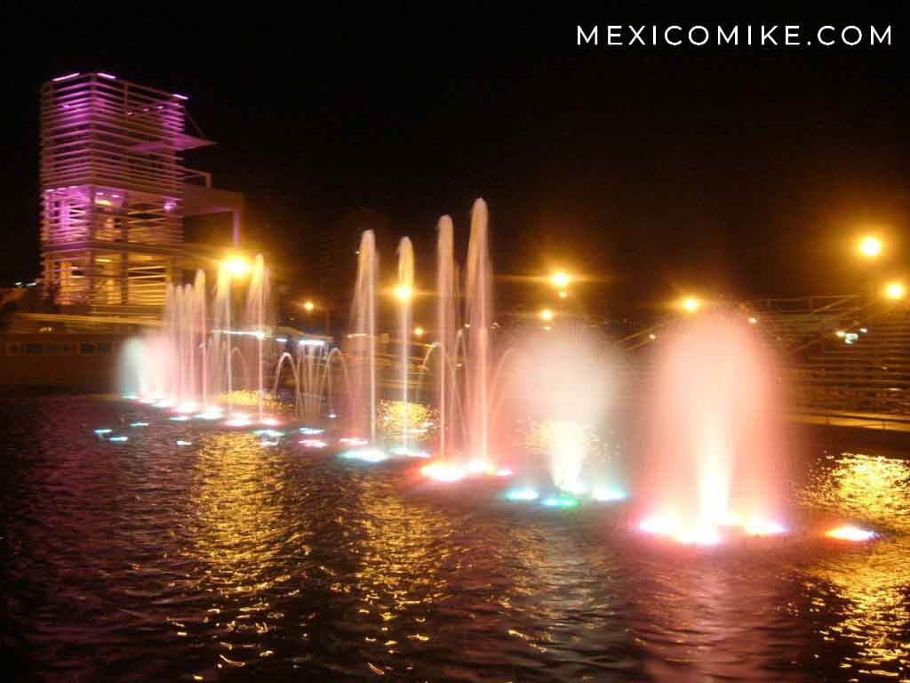
Located in the center of the state, the capital boasts a beautiful colonial center as well as many attractions that are popular among visitors. Some of the city’s most revered sites and attractions include the Temple of San Francisco, the Government Palace, El Palomar Central Park, the Church of Santa Rita, the Chihuahua Cathedral, and the Museum of Religious Art. For eco-adventurers, the Grutas de Nombre de Dios is a series of caves that are famous for their stalactites and stalagmites.

Parral
This city, widely known for its European style and charm, is less than 140 miles from the capital. Historically populated by many Spanish and French, the city retains many aspects of these peoples in terms of architecture and even culture. Some of the city’s most popular sites include the Plaza Guillermo Baca, the historic El Hotel Hidalgo, El Palacio de Alvarado, and the Francisco Villa Museum.
Other Things to See and Do in the State of Chihuahua

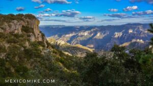
Copper Canyon: This notable series of six major (and many smaller) canyons bigger than the Grand Canyon. Located in the Sierra Madre in the southwestern region of Chihuahua, the landscape is one of the most important ecological attractions of the state.
Paquime: Also known as Casas Grandes, this northern site is the most significant archaeological zone in the state. This Puebloan site was at its peak during the thirteenth century.
Creel: This town is the gateway to the canyon country of the Sierra Tarahumara. It’s the ideal base for adventures that want to horseback ride or hike through the stunning surrounding landscape.
Basaseachi National Park: With many scenic trails, this national park is home to Mexico’s highest waterfall.
Cumbres de Majalca National Park: This area is one of the few regions in the countries where people can still see black bears; it’s a favorite place among hikers and bird waters, too.